Editing PSS and EGIS Service
Use the Edit tab to edit vector data provided by the PSS or EGIS service.
![]()
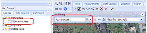
![]() To edit vector data provided by the service, ensure that the feature class layer containing features to be edited is checked in the Map Content tab so that it displays in in the map window.
To edit vector data provided by the service, ensure that the feature class layer containing features to be edited is checked in the Map Content tab so that it displays in in the map window.
| Top of Page |